


Voting District 070003, Delaware County, New York
About
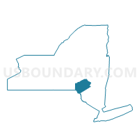
Outline

Summary
| Unique Area Identifier | 626183 |
| Name | Voting District 070003 |
| County | Delaware County |
| State | New York |
| Area (square miles) | 23.00 |
| Land Area (square miles) | 22.91 |
| Water Area (square miles) | 0.10 |
| % of Land Area | 99.58 |
| % of Water Area | 0.42 |
| Latitude of the Internal Point | 42.39918290 |
| Longtitude of the Internal Point | -75.10448660 |
Maps


Graphs
Select a template below for downloading or customizing gragh for Voting District 070003, Delaware County, New York


Neighbors
Neighoring Voting District (by Name) Neighboring Voting District on the Map
- Voting District 040001 040002, Delaware County, NY
- Voting District 070001, Delaware County, NY
- Voting District 070002, Delaware County, NY
- Voting District 130001, Delaware County, NY
- Voting District 140004, Otsego County, NY
- Voting District 160001, Otsego County, NY
- Voting District 160001 160003, Delaware County, NY
- Voting District 160002, Otsego County, NY
Top 10 Neighboring County Subdivision (by Population) Neighboring County Subdivision on the Map
- Sidney town, Delaware County, NY (5,774)
- Oneonta town, Otsego County, NY (5,229)
- Otego town, Otsego County, NY (3,115)
- Davenport town, Delaware County, NY (2,965)
- Franklin town, Delaware County, NY (2,411)
- Meredith town, Delaware County, NY (1,529)
Top 10 Neighboring Place (by Population) Neighboring Place on the Map
Top 10 Neighboring Unified School District (by Population) Neighboring Unified School District on the Map
- Oneonta City School District, NY (20,416)
- Otego-Unadilla Central School District, NY (6,828)
- Franklin Central School District, NY (2,066)
Top 10 Neighboring State Legislative District Lower Chamber (by Population) Neighboring State Legislative District Lower Chamber on the Map
- Assembly District 111, NY (132,613)
- Assembly District 127, NY (129,764)
- Assembly District 107, NY (125,994)
Top 10 Neighboring State Legislative District Upper Chamber (by Population) Neighboring State Legislative District Upper Chamber on the Map
Top 10 Neighboring 111th Congressional District (by Population) Neighboring 111th Congressional District on the Map
Top 10 Neighboring Census Tract (by Population) Neighboring Census Tract on the Map
- Census Tract 9704, Delaware County, NY (5,774)
- Census Tract 5914, Otsego County, NY (5,539)
- Census Tract 5908, Otsego County, NY (5,229)
- Census Tract 9701, Delaware County, NY (4,542)
- Census Tract 9702, Delaware County, NY (3,204)
- Census Tract 9703, Delaware County, NY (2,411)